
Utsikt fra Øyna. Foto: Wil-Lee Wright
Mosvik und Framverran entdecken
Am äußersten Rand der Gemeinde Inderøy – jenseits der imposanten Skarnsundbrücke, wo sich die sanften Ausläufer des Trondheimsfjords ihren Weg ins Landesinnere bahnen – liegen die Orte Framverran und Mosvik. Umgeben von einer atemberaubenden Küstenlandschaft, lebendigen Traditionen und kleinen Erlebnisperlen bieten die beiden Orte einen Einblick in Geschichte, regionale Küche und das authentische Dorfleben in Trøndelag.
Gullstatuen av Petter Northug. Foto: Explorative AS
Framverran
Framverran begeistert mit seiner traumhaften Lage, einer abwechslungsreichen Kulturlandschaft – und als Heimat der norwegischen Skilanglauflegende Petter Northug. Über Northug-opplevelser können Sie den Hof Selli und die Umgebung entdecken, in der Petter Northug aufgewachsen ist. John heißt Gruppen und Unternehmen herzlich willkommen und erzählt gerne mehr über die Kindheit der Northug-Brüder und die Geschichte hinter ihrem sportlichen Erfolg.
Direkt am Wasser lädt das Northugnaustet dazu ein, regionale Spezialitäten in besonderer Atmosphäre zu genießen. Northug-opplevelser empfängt hier das ganze Jahr über Gruppen.
Ein beliebter Wanderweg, die Northug-Runde, führt am Hof vorbei. Entlang des Weges informieren Tafeln über Petter Northugs Kindheit und seine Verbindung zu dieser Region.
Nicht weit vom Northugnaustet erwartet Sie außerdem eine beeindruckende goldene Statue von Petter Northug, die 2024 zu Ehren seiner außergewöhnlichen sportlichen Karriere enthüllt wurde. Ob für ein Selfie mit „Petter“ oder einfach für eine wohlverdiente Pause – die Statue ist ein beliebter Zwischenstopp auf Ihrer Tour durch Framverran.
Venneshamn – historischer Handelsplatz
Venneshamn in Framverran war von 1888 bis 2008 ein wichtiger Handelsplatz und beherbergte von 1997 bis 2009 sogar eine Filiale der Verran Sparebank.
Viele Jahre lang war Venneshamn außerdem Anlegestelle für Passagierschiffe und die Fährverbindung Vangshylla–Kjerringvik. Erst mit dem Ausbau der Straßenverbindung im Jahr 1968 verlor der Ort diese wichtige Funktion.
Solange Framverran zur Gemeinde Verran gehörte, war Venneshamn das natürliche Zentrum des Ortes – ein lebendiger Treffpunkt für Handel, Verkehr und das lokale Leben.
Mehr über die Routen der Passagierschiffe erfahren
The Route Boats of Venneshamn – A Maritime Era
From the late 1800s, steamships became vital for trade and transport along the Trondheimsfjord. In 1889, Venneshamn received its first steamship call with the DS Indtrønderen, and Ernst Karlsen was appointed station agent. After a merger of steamship companies around 1890, the station was moved to Selsetvika, but Venneshamn later returned as a regular stop.
Over the years, several route boats called at Venneshamn, including:
- DS Kong Oscar (1889–1950)
- DS Innherred (from 1929)
- MS Aalfjord (1954–1969)
- MS Steinkjer (1968–1974)
- MS Fjellmann (1971–1977)
In 1977, the route boat calls ended when Fjellmann was withdrawn from service, and sea transport was replaced by land-based traffic. The harbor conditions in Selsetvika were eventually deemed less suitable, and Venneshamn, with its sheltered location, took over.
For nearly a hundred years, the pier at Venneshamn was a social gathering point. When the boats docked, locals would gather to see who and what arrived—a cherished part of village life.
Kilde – Bakgrunnstekst om postene på kulturminnest om rutebåtene i Selsetvika-Venneshamn
Mehr über die Autofähre erfahren
The Car Ferry and Fjord Crossing – From Rowboat to Route Boat
Fjord crossings at Skarnsundet have unfolded in three distinct eras:
- Transport stations with rowboats and horses from the late 1800s
- Motorboat routes across the fjord in the 1950s
- Car ferry routes from 1958 to 1968
Transport stations on both sides of the strait offered travel by land and sea. Vennes station is documented as early as the 1870s, with sea transport being the most common. Motorboat service between Venneshamn and Norem continued until the 1920s.
In the 1950s, motorboats such as MS Frøviksund and MS Strindfjord carried mail, goods, passengers, and milk between Levanger and Venneshamn. Milk was delivered by horse to the pier and shipped onward to the dairy—a routine that continued until the ferry took over.
Innherredsferja AS was founded in 1957, and from 1958 the ferry ran three times daily between Venneshamn, Kjerringvik, Vangshylla, Ytterøy, and Levanger. The ferry dock was built at the steamship pier, and Innherredsferja I and II served the route until 1968.
When the road along Skarnsundet opened in 1968, the ferry became obsolete. The Skarnsund Bridge, completed in 1991, ended ferry traffic entirely. The shift from sea to land transport diminished Venneshamn’s role as a trading hub.
The motorboat Tur, captained by Arne Mollan, operated between Venneshamn and Skjelstad from the late 1950s to the 1960s. It transported schoolchildren, dental patients, and bakery goods—an essential link in daily life.
Foto: Lena Johnsen
Foto: Explorative AS
Selsethloftet – Hofladen und Café
Ein Hofladen mit Herz – Hier erwartet Sie eine liebevoll zusammengestellte Auswahl an Wohnaccessoires, Wolle, Handtaschen, Keramik und regionalen Spezialitäten. In der kleinen Secondhand-Ecke finden Sie außerdem allerlei schöne Schätze aus der Umgebung.
Hausgemachte Köstlichkeiten im Café – Jeden Freitag das ganze Jahr über sowie an den Wochenenden während der Sommersaison serviert Berit Kaffee, Kuchen und Desserts in gemütlicher und herzlicher Atmosphäre.
Sommererlebnisse für die ganze Familie – Unternehmen Sie einen Spaziergang auf dem schönen Wanderweg, spielen Sie eine Runde Discgolf, lernen Sie die Schafe und die kleinen Dexter-Rinder kennen oder erkunden Sie den Kulturpfad zwischen Selsetvika und Venneshamn (2 km).
Kalsen Landhandel Museum – Erinnerungen hinter dem Ladentresen
Der Landhandel in Venneshamn war von 1888 bis 2008 ein wichtiger Handelsplatz und wurde über vier Generationen von der Familie Karlsen geführt. Dank des guten Hafens und seiner Lage an der Schiffsroute zwischen Trondheim und Steinkjer war der Ort ein bedeutender Knotenpunkt für Handel, Fischerei und Schiffsverkehr.
Das Geschäft bot alles, was man im Alltag brauchte – von Lebensmitteln, Textilien und Eisenwaren bis hin zu einer Fischannahmestelle, einer Bäckerei und einem Postamt. Gleichzeitig war der Landhandel nicht nur Einkaufsort, sondern auch ein wichtiger Treffpunkt für die Menschen vor Ort. Nach seiner Schließung im Jahr 2008 wurden die Gebäude restauriert und das Landhandel-Museum eingerichtet. Heute dient es als kultureller Treffpunkt mit Bewirtung, Veranstaltungen und spannenden Geschichten aus vergangenen Zeiten.
Im Museum gibt es außerdem einen eigenen Bereich, der Martin Kvennavika gewidmet ist.
Mehr über den Handelsplatz Venneshamn erfahren
The General Store in Venneshamn has a history dating back to 1888, when Ole Karlsen began trading at the site. With its excellent harbor and strategic location along the shipping route between Trondheim and Steinkjer, Venneshamn became a natural stop for boat traffic, fishermen, and locals. People gathered here to shop, deliver fish, exchange news, and enjoy a chat—the store was as much a social hub as it was a place of commerce.
Over four generations, the Karlsen family expanded and adapted the business to meet the needs of the times. The shop sold groceries, textiles, hardware, paint, tools, and fishing gear, and also housed a fish reception, bakery, telephone exchange, and post office. It was known for its hospitality and the close relationships between shopkeepers and customers—everyone knew each other here.
The store remained open until 2008, when operations ceased. The buildings, however, stood as a powerful symbol of the village’s history and community spirit, and were later restored with the aim of preserving both the cultural heritage and the atmosphere of the store’s golden days.
Today, the General Store Museum in Venneshamn is a vibrant cultural venue. Visitors can experience authentic interiors, vintage goods, and stories from a time when coastal trade was the lifeblood of the village. The museum opens on select weekends during summer, offering a café, exhibitions, and events such as music evenings and “Fresh Bread and Aged Cheese”—a flavorful journey through local food and history, held during Framverrandåggån.
A visit here is like stepping back in time: you can smell freshly baked bread, hear the sound of the sea outside, and imagine everyday life in the coastal villages more than a hundred years ago.
The General Store Museum Kalsen is run by Ole Karlsen’s great-grandson, Asbjørn Kalsen, and his wife.
Mehr über Martin Kvennavika erfahren
Martin Kvennavika – Trøndelag’s Great Tall-Tale Teller
Martin Kvennavika was a fictional character created by Olav Berg from Steinkjer—a master dyer, poet, and legendary storyteller. According to Berg, Martin was born “in a little red-painted cottage by the sea” in Kvennavika, and the house was later moved to Kvernes to serve as a summer retreat.
Olav Berg (1855–1946) led an adventurous life: he went to sea at 18, spent eight years in America, and took over his father’s dye works in Steinkjer in 1888. Inspired by Fridtjof Nansen’s polar expedition, he penned the tall tale “When Martin Kvennavika Sailed to the North Pole in the Survik Jekt”, earning him the nickname Trøndelag’s answer to Baron von Münchhausen
Berg drew inspiration from Venneshamn and the surrounding area, where he vacationed with merchant Ernst Karlsen—a commission agent for the dye works. It was here that stories emerged about the crew of the Survik Jekt, including the bear hunt in Mosvikfjelle and the marksman who hit the measuring stick instead of the target at the shooting festival.
The correspondence between Berg and Karlsen (1899–1930) reveals a blend of business and friendship, filled with poems, humor, and commentary on the times. Olav Berg became a beloved figure in Steinkjer, celebrated with torchlight processions on both his 70th and 90th birthdays.
Martin Kvennavika came to symbolize the impossible made possible—like sailing through an underwater tunnel from Verrabotn to the North Pole to rescue Nansen.
You can explore more about Martin Kvennavika and Olav Berg through
Foto: Explorative AS
Ta med om kulturminnevandringen med infoplakater,
Skarnsundet, fergetrafikken, etc etc
Foto:Explorative AS
Mosvik – das charmante Fjorddorf
Mosvik ist ein Dorf, das eng mit dem Fjord und der Landwirtschaft verbunden ist. Es liegt am Beitstadfjord, einem Seitenarm des Trondheimsfjords, und ist für sein mildes Klima und die hervorragenden Bedingungen für die Landwirtschaft bekannt.
Der Name Mosvik bedeutet vermutlich „die Bucht mit Moos“ oder „die Bucht am Moos“. Das Gebiet ist bereits seit prähistorischer Zeit besiedelt. Im Mittelalter gehörten Höfe wie Vinje bruk zum Besitz der Kirche und des Königshauses. Von 1904 bis 2012 war Mosvik eine eigenständige Gemeinde, bevor der Ort mit Inderøy zusammengelegt wurde. Bis heute ist Mosvik eine lebendige Gemeinschaft mit einer ausgeprägten lokalen Identität.
Mosvik Brygge ist ein saisonales Restaurant mit eigenem Anleger. In den Sommermonaten können Sie hier mit dem Boot anlegen und Kajaks mieten. Mehr über die Geschichte von Mosvik Brygge erfahren Sie weiter unten.
Von Vinje brygge zum Anleger von Mosvik
Vinjesjøen developed into a local trading center in the mid-1800s, especially during the time of Benedict Jenssen, when steamships required sturdy piers and large warehouses. By the 1870s, the site had two warehouses and a shop, and the pier area became a vital hub for both freight and passenger traffic until the late 1960s.
IIn Norway’s Cultural Heritage Year of 1997, the old pier and warehouse were designated as Mosvik’s official heritage site. This sparked renewed interest in preserving the area. In 2004, Karl Olaf Damås began extensive restoration work, and by 2005 the pier was back in use—now including a café. New facilities, such as restrooms and a rental cabin, were added in 2006, and the area was gradually adapted for year-round use.
After the municipal merger with Inderøy, the site was renamed Mosvik Brygge to strengthen its connection to local identity. Once neglected and underused, the area has now become an attractive gathering place and cultural venue, blending historic buildings with modern amenities.
Source: fra utfyllende informasjonslink til post 24 – „Vinjesjøen Våkner“ fra Kulturminnestien Mosvik
Mehr über Vinje Gård erfahren
Vinje Farm in Mosvik, Trøndelag, is the largest agricultural and forestry estate in the area, known since 1430 as property of the Archbishop.
After serving as church and crown land, the farm passed through several owners, including Gabriel Marselis, Petter Høier, Andreas Bull, and multiple generations of the Jenssen family, who have owned the estate since 1820. Many of its owners have also served as mayors and held key roles in the local community.
Over the centuries, the farm has hosted a wide range of operations, including a sawmill, distillery, dairy, creamery, grain mill, small hydroelectric plant, and general store. Today, it is run as a modern enterprise with cattle farming, grain production, forestry, and outfield resource management. The property spans over 52,000 decares, of which 36,000 decares are productive forest.
The main building was constructed in the 1890s, replacing an older structure with a rare saddle-shaped roof. Vinje Farm also holds a place in Norwegian literature and local history, featured in several books and memoirs.
Mosvik Museum – Eine Reise durch die Geschichte der Region
Mosvik Museum – Eine Reise durch die Geschichte der Region
Das Mosvik Museum ist ein liebevoll geführtes Heimatmuseum, das von engagierten Ehrenamtlichen betrieben wird. Es ist im Sommer geöffnet und kann nach vorheriger Vereinbarung auch außerhalb der regulären Öffnungszeiten besucht werden.
Unter dem herzlichen Motto „Wir bewahren die Vergangenheit, weil wir unser Dorf lieben“ machen das Museum und der örtliche Geschichtsverein das kulturelle Erbe von Mosvik lebendig. Ausstellungen, Kulturpfade, Vorträge, ein Fotoarchiv und verschiedene Publikationen erzählen von der Geschichte und dem Leben in der Region.
Entdecken Sie das Museum
- Jährlich wechselnde Sommerausstellungen
- Grande School – erbaut im Jahr 1886
- Die Schmiede mit Werkzeugen des Dorfschmieds Ole Gjerde
- Nesstu – ein restauriertes Häuslerhaus aus der Zeit von den 1930er- bis in die 1960er-Jahre
- Kaldalstua – einst Wohnhaus eines Försters, heute Treffpunkt und Heimat des Museumsladens
<[/et_pb_text][/et_pb_column] Foto: Explorative AS
Foto: Tommy Norum
Die Skarnsundbrücke – ein Wahrzeichen der Region
Die Skarnsundbrücke – ein Wahrzeichen der Region
Die Skarnsundbrücke verbindet Mosvik mit dem übrigen Inderøy und ist ein beeindruckendes Beispiel moderner Schrägseilbrückenbaukunst. Einst gehörte sie zu den längsten Brücken ihrer Art weltweit. Ihre markanten roten Seile ragen wie die Saiten einer riesigen Harfe in den Himmel und bilden einen eindrucksvollen Kontrast zur nordischen Landschaft.
Unterhalb der Brücke erstreckt sich der Skarnsund, ein beliebtes Ziel für Taucher und Angler. Die Meerenge verbindet den Trondheimsfjord mit dem Beitstadfjord und ist für ihre starken Gezeitenströmungen und ihre artenreiche Unterwasserwelt bekannt.
Im Jahr 2008 wurde die Skarnsundbrücke vom norwegischen Denkmalamt offiziell unter Denkmalschutz gestellt – eine Anerkennung ihrer besonderen architektonischen und kulturhistorischen Bedeutung.
Skarnsundet
Wo der Trondheimsfjord auf den Beitstadfjord trifft, liegt der Skarnsundet – ein Ort, an dem die Gezeiten kraftvoll durch die Meerenge strömen, die Fische beißen und sich unter der Wasseroberfläche das flachste bekannte Kaltwasserkorallenriff der Welt verbirgt.
Skarnsundet – unberührte Natur und seltene Korallenriffe
Skarnsundet – Where Fjords Meet and Nature Thrives
Skarnsundet is the spectacular strait that links the Trondheimsfjord with the Beitstadfjord.
Stretching about 4 km in length and narrowing to just 600 meters at its slimmest point, the strait is framed by steep hills sculpted by glaciers during the Ice Age. Here, massive volumes of tidal water surge through the narrow passage, creating powerful currents—ideal conditions for fishing.
Since the Stone Age, Skarnsundet has served as a vital source of food, as evidenced by ancient rock carvings of flatfish found in Kvennavika.
The strait remains ice-free almost year-round and has long been a safe maritime route. The beacon at Vennesodden has guided boats through the darkness for generations, and fishers still flock here to catch pollock and other species drawn to the rushing waters.
But beneath the surface, Skarnsundet hides a globally rare treasure: some of the world’s shallowest cold-water coral reefs. Among the species found here are sea trees, grain coral, sea shrubs, eye coral, and zigzag coral—fragile, slow-growing organisms that can live for over a thousand years. The strong currents, steep underwater cliffs, and pristine water create ideal conditions for these ancient reefs.
In 2020, the Skarnsundet Marine Protected Area was established to safeguard this unique ecosystem. Spanning 18.5 km², it hosts a rich diversity of marine life and is a popular destination for sport diving—especially for experienced divers eager to explore the coral forest up close. Starting in 2025, BareDykk in Småvika will offer guided dive tours, courses, and overnight stays.
Whether you’re standing on the Skarnsund Bridge gazing down at the tidal currents, fishing from shore, sailing through the strait, or diving beneath the waves, Skarnsundet offers an experience that blends dramatic nature, deep history, and one of Norway’s most precious marine environments.
Foto: Explorative AS
Wander- und Radtipps in Mosvik und Framverran
Storknuken – 8,5 km hin und zurück
The hike to Storknuken, Inderøy’s highest point, offers wonderful nature experiences. From the car park in Bjørvikdalen, you follow forest roads and trails up to the summit, where a large, old cairn marks the destination. The view from the top gives you panoramic vistas of Inner Trøndelag. This is a well-known and popular hiking destination that can be reached via several routes.
The hike: The route is 4.5 km (9 km round trip) and follows a marked and signposted trail north of Hundtjønnin. Check in at the stone cairn on Storknuken. Alternatively, you can take the trail from the end of the forestry road on the north side of Ålvatnet (not marked). There are several good fishing lakes along the way to Storknuken – Mosvik permit required.
Access: Drive 4.3 km west on County Road 755 from Skarnsund Bridge to Grandkorsen. Turn off onto County Road 192 and follow it for 1.7 km past the industrial area in Nervika. Then turn right just after the industrial area (by Slir Bridge) and follow Dalshaugvegen to Stordalsvatnet. Turn left across the dam at the eastern end of Stordalsvatnet and continue along the forestry road for 1.3 km to the car park.
Parking: Parking at the timber storage area at Bekkøyin.
Northug-Runde – 6 km hin und zurück
Start and finish at Vestvik Church in Framverran, Inderøy. The route follows local roads and passes right by the farm where the ski legend Petter Northug grew up. Information boards along the way tell the story of Petter’s childhood. A great trail that can also be jogged, and is suitable for prams and walkers.
Hikedescription on ut.no. – in Norwegian with zoomable map. Translation to Englsih below)
Northugrunden
- Distance: approx. 6 km
- Time: about 1 hour 30 minutes
- Type: Round trip
- Elevation gain: 149 m
- Season: All year
Start and finish: Vestvik Church in Framverran, Inderøy.
The route follows local roads and passes right by the farm where Petter Northug grew up. Along the way, information boards and signs tell the story of Petter’s childhood. This is a beautiful trail that can also be jogged, and is suitable for prams and walkers.
Midway, you’ll find Rognlisveet, a former crofter’s holding under Rognli farm, with a bench for a rest. The trail runs through Petter Northug’s childhood landscape – where he played, dreamed, ran, and skied, and later used for recovery during his skiing career.
Access:
- Drive on County Road 755 from Straumen in Inderøy over Skarnsund Bridge. Turn left onto County Road 191 towards Framverran (signposted Northugrunden). Continue about 9 km past Framverran centre and Gipling Camping. Turn right at the junction for Vestvik Church.
- Parking: At the church car park. Free.
Nordbygdastiene – 3,6 km einfache Strecke
Trail network starting from the rest area on the west side of Skarnsund Bridge. The network covers a total of 17 km. The roads and paths are hilly and vary in difficulty from moderately challenging to demanding. Viewpoints at Korpåsen, Storlia, Reitan and Øksnåsen. Five fitness boxes along the routes.
It’s also possible to start hikes from Mosvik centre – with several options for circular routes.
All trails are marked and signposted.
Region: Nord-Trøndelag, Trøndelag
Type: Demanding hike
Distance: 3.6 km
Time: 2 hours
Route: One-way, from A to B
Total elevation gain: 150 m
Season: May–November
Access by car
Drive along County Road 755 to the rest area at the western end of Skarnsund Bridge. Parking is available here. If you continue on County Road 755 from Skarnsund Bridge to Mosvik centre (4 km), there is parking at Mosvang community hall and Mosviktun (local museum).
Hikedescription on ut.no (in Norwegian but with a zoomable map)
Hamnasetran – 6,3 km hin und zurück
This is an easy and pleasant walk along the old village road in Åsbygda to Hamnasetran (mountain farm), which sits high and open with beautiful views over large parts of Innherred. The mountain pasture is well adapted for outdoor activities. In addition to the traditional summer farm buildings, there is a fine lean-to shelter. From the pasture, you can take a short detour to the top of Skavelsåsen (401 m above sea level), with the TV mast as a prominent landmark.
Hike description on ut.no in Norwegian but with zoomable map
Region: Nord-Trøndelag, Trøndelag
Difficulty: Moderately challenging hike
Distance: 6.3 km
Time: 1 hour 30 minutes
Type: Circular route
Total elevation gain: 232 m
From the car park, follow the road up the hills and through the Langaunet Øvre farm. Grazing animals are in the area, so it is important to close gates where they are passed. Dogs must be kept on a lead. Continue following the marked trail through the forest up to the pasture. Along the entire route, information boards provide details about old settlements and the people who lived here, as well as the flora and fauna of the area. Hamnasetran has Mosvik’s only preserved summer farm buildings and is idyllically located with a stunning view towards the fjord.
On the large, open pasture, facilities include a lean-to shelter, barbecue area, and fire pit. From the pasture, you can continue across the marshes to Skavelsåsen, with the TV mast towering on the summit. On the way back, follow the marked trail from the pasture over Aunåsen, past the lean-to shelter at Stamtjønna, and along the forest road down to Langaunet Øvre. From here, follow the road back through the farm and down the hillside to the car park at the community hall.
Access
Follow County Road 755 for 4.3 km west from Skarnsund Bridge to Grandkorsen. Turn off onto County Road 192 (FV6920) towards Sliper. Follow this road for 5 km to Staberg. Here, turn right towards Åstun community hall.
Parking
Parking at Åstun community hall.
Liatjønna – 800 m hin und zurück
Liatjønna – Accessible Nature and Fishing Spot
Liatjønna is located between Leksvik and Mosvik along County Road 755, just 50 metres from the main road, with clear signage. This is one of the best-organised family fishing spots in the region, featuring:
- Three fishing piers
- A 400-metre wheelchair-accessible path
- Nature trail with information boards
- Shelter, three barbecues, tables and benches
- Woodshed, water regulation pond and toilet facilities
The area is particularly well suited for outdoor recreation and fishing for people with disabilities. Fishing licences and answer sheets for the nature trail quiz can be purchased at the information board (self-service). The pond is stocked with high-quality fish – char and trout.
The hike
The trail follows the wheelchair-accessible path around Liatjønna to the destination on the southern side of the pond – approx. 800 m round trip. Here you can enjoy coffee brewing, barbecuing, and fishing in a peaceful setting.
Access
Follow County Road 755 from Skarnsund Bridge towards Leksvik for 15 km. Liatjønna is signposted from the road.
Parking
Designated parking is available on the south side of County Road 755.
Die große Rundtour durch Mosvik mit dem Fahrrad – 56 km
Region: Nord-Trøndelag, Trøndelag
Difficulty: Demanding cycle tour
Distance: 56.3 km
Time: approx. 5 hours
Type: Circular route
Total elevation gain: 800 m
Season: April – September
Start from Mosvik centre and cycle past Vinje Bruk and Mosvik Church. When the gravel road meets County Road 755 towards Leksvik, turn left and follow it until you see signs for Trongsundet after 14 km.
Along the way, you’ll likely pass sheep grazing by the roadside, lazily watching the traffic. Let yourself be inspired to enjoy the surrounding nature at a slower pace.
Recommended stop: Liatjønna – a beautiful rest area with shelters and toilets. Shortly after Liatjønna, you’ll pass Meltingvatn, where the water level is regulated for the power station.
From here, the road descends towards Trongsundet, and you’ll almost coast for a couple of kilometres. At Hovd, the road becomes asphalted again and more hilly as you follow the Verrasundet fjord arm towards Framverran and Skarnsundet. At Vikavatnet, there’s a lovely spot for a break with tables and benches. Shortly after, “Tverråveien” joins in, where the route briefly touches Mosvikrunden.
Soon you’ll pass Vestvik Church and Venneshamn. Just before Kjerringvik, you can stop to see some unique rock carvings hidden close to the road.
Back at Mosvik Brygge, we recommend rounding off your ride with a good meal. If you’d like to freshen up before dinner, showers are available – pure luxury after a long ride!
Stages:
- Mosvik to junction with County Road 193 (towards Trongsundet): 16.4 km
- Over and down to the fjord at Hovd: 13 km
- Hovd to Vestvik Church: approx. 12 km
- Vestvik Church along Skarnsundet: 12 km
- Final stretch back to Mosvik centre: 4 km
Access by car:
From the E6: Follow E6 to Røra, Inderøy. Turn west onto County Road 755 towards Mosvik. Continue straight for 25 km, then turn left into Mosvik centre. Drive past the shop and continue straight to Mosvik Brygge.
Bikedescription on ut.no (in Norwegian but with a zoomable map)
Kulturpfad durch Mosvik – 4,5 km hin und zurück
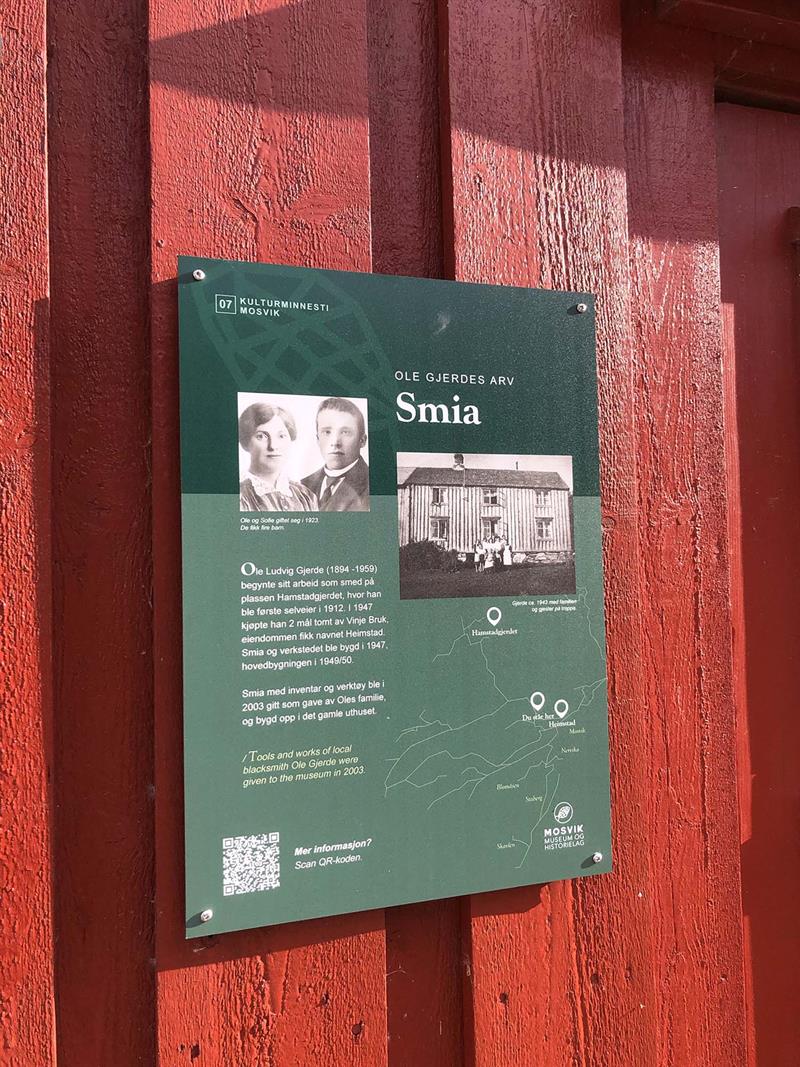
Mosvik Heritage Trail
Mosvik Cultural Heritage Trail – a historical walk of 4.5 km
Explore the centre of Mosvik through a cultural heritage trail that gives you an insight into the village’s rich history. The trail takes you on a journey through the stories of the people, buildings and businesses that have shaped Mosvik.
The trail starts at Mosvik Museum and follows the river Mossa, past the school and Mosvikstranda, before passing through the town centre and on to the Nervika industrial area. The trail ends at Vinje Bruk and the church. Along the route, you’ll find 34 informative information points, where each point gives you exciting insights into the past.
The cultural heritage trail has an English summary and QR codes for more information.
Kulturpfad Selsetvika–Venneshamn – 2 km
– A Journey Through History
Discover the 2 km Selsetvika/Venneshamn Heritage Trail, which leads you through an area rich in cultural heritage from various time periods. Opened in 2024, the trail offers a fascinating journey through local history.
Along the way, you can explore rock carvings, burial mounds, historic trading houses, old farmsteads, steamboat routes, post and banking operations, and learn about the lives of the district doctor, the captain, the blacksmith, and the impoverished. The trail features 32 information boards that share intriguing stories and facts.
We recommend starting your walk at the small marina in the northern end or at the rock carvings in the southern end and completing the trail as a round trip. Please be cautious when walking along the road.
All signs include English summaries and QR codes for additional information (this in Norwegian).
Die kleine Rundtour durch Mosvik mit dem Fahrrad – 28 km
Region: Nord-Trøndelag, Trøndelag
Difficulty: Moderately challenging cycle tour
Distance: 28.6 km
Time: approx. 2 hours 30 minutes
Type: Circular route
Total elevation gain: 383 m
Season: April – October
Round Trip in the skilegend Petter Northug’s Homeplace
Start from Mosvik centre and cycle past Vinje Bruk and Mosvik Church. When the gravel road meets County Road 755 towards Leksvik, turn left and follow it until you see signs for Trongsundet after 14 km.
Along the way, you’ll likely pass sheep grazing by the roadside, lazily watching the traffic. Let yourself be inspired to enjoy the surrounding nature.
Take the first road to the right after the bends on County Road 755. A gravel road descends slightly, and soon you’ll reach Årningan. Signs warning of a winter-closed road give a sense of heading into wilderness and forest. A wonderfully peaceful ride along Tverråveien awaits you, surrounded only by the sounds of the forest. Stop for a break whenever you wish.
When you reach the asphalt road, turn right and follow it towards Framverran and onwards to Skarnsundet. Soon you’ll pass Vestvik Church and Venneshamn. Just before Kjerringvik, you can stop to see some unique rock carvings hidden close to the road. There’s also a lovely spot by the water for a break.
Continue left along the fjord back to Mosvik centre. If you need a toilet, there’s one at the rest area on your right when you rejoin County Road 755 – a great place to take a photo of Skarnsund Bridge too!
Back at Mosvik Brygge, we recommend finishing your ride with a good meal. Showers are available if you’d like to freshen up, or you can simply take a dip in the sea – pure luxury!
Access by car
From the E6: Follow E6 to Røra, Inderøy. Turn west onto County Road 755 towards Mosvik. Continue straight for 25 km, then turn left into Mosvik centre. Drive past the shop and continue straight to Mosvik Brygge.
Bikedescription on ut.no (in Norwegian but with a zoomable map)
Storknuken – 8,5 km hin und zurück
The hike to Storknuken, Inderøy’s highest point, offers wonderful nature experiences. From the car park in Bjørvikdalen, you follow forest roads and trails up to the summit, where a large, old cairn marks the destination. The view from the top gives you panoramic vistas of Inner Trøndelag. This is a well-known and popular hiking destination that can be reached via several routes.
The hike: The route is 4.5 km (9 km round trip) and follows a marked and signposted trail north of Hundtjønnin. Check in at the stone cairn on Storknuken. Alternatively, you can take the trail from the end of the forestry road on the north side of Ålvatnet (not marked). There are several good fishing lakes along the way to Storknuken – Mosvik permit required.
Access: Drive 4.3 km west on County Road 755 from Skarnsund Bridge to Grandkorsen. Turn off onto County Road 192 and follow it for 1.7 km past the industrial area in Nervika. Then turn right just after the industrial area (by Slir Bridge) and follow Dalshaugvegen to Stordalsvatnet. Turn left across the dam at the eastern end of Stordalsvatnet and continue along the forestry road for 1.3 km to the car park.
Parking: Parking at the timber storage area at Bekkøyin.
Northug-Runde – 6 km hin und zurück
Start and finish at Vestvik Church in Framverran, Inderøy. The route follows local roads and passes right by the farm where the ski legend Petter Northug grew up. Information boards along the way tell the story of Petter’s childhood. A great trail that can also be jogged, and is suitable for prams and walkers.
Hikedescription on ut.no. – in Norwegian with zoomable map. Translation to Englsih below)
Northugrunden
- Distance: approx. 6 km
- Time: about 1 hour 30 minutes
- Type: Round trip
- Elevation gain: 149 m
- Season: All year
Start and finish: Vestvik Church in Framverran, Inderøy.
The route follows local roads and passes right by the farm where Petter Northug grew up. Along the way, information boards and signs tell the story of Petter’s childhood. This is a beautiful trail that can also be jogged, and is suitable for prams and walkers.
Midway, you’ll find Rognlisveet, a former crofter’s holding under Rognli farm, with a bench for a rest. The trail runs through Petter Northug’s childhood landscape – where he played, dreamed, ran, and skied, and later used for recovery during his skiing career.
Access:
- Drive on County Road 755 from Straumen in Inderøy over Skarnsund Bridge. Turn left onto County Road 191 towards Framverran (signposted Northugrunden). Continue about 9 km past Framverran centre and Gipling Camping. Turn right at the junction for Vestvik Church.
- Parking: At the church car park. Free.
Nordbygdastiene – 3,6 km einfache Strecke
Trail network starting from the rest area on the west side of Skarnsund Bridge. The network covers a total of 17 km. The roads and paths are hilly and vary in difficulty from moderately challenging to demanding. Viewpoints at Korpåsen, Storlia, Reitan and Øksnåsen. Five fitness boxes along the routes.
It’s also possible to start hikes from Mosvik centre – with several options for circular routes.
All trails are marked and signposted.
Region: Nord-Trøndelag, Trøndelag
Type: Demanding hike
Distance: 3.6 km
Time: 2 hours
Route: One-way, from A to B
Total elevation gain: 150 m
Season: May–November
Access by car
Drive along County Road 755 to the rest area at the western end of Skarnsund Bridge. Parking is available here. If you continue on County Road 755 from Skarnsund Bridge to Mosvik centre (4 km), there is parking at Mosvang community hall and Mosviktun (local museum).
Hikedescription on ut.no (in Norwegian but with a zoomable map)
Hamnasetran – 6,3 km hin und zurück
This is an easy and pleasant walk along the old village road in Åsbygda to Hamnasetran (mountain farm), which sits high and open with beautiful views over large parts of Innherred. The mountain pasture is well adapted for outdoor activities. In addition to the traditional summer farm buildings, there is a fine lean-to shelter. From the pasture, you can take a short detour to the top of Skavelsåsen (401 m above sea level), with the TV mast as a prominent landmark.
Hike description on ut.no in Norwegian but with zoomable map
Region: Nord-Trøndelag, Trøndelag
Difficulty: Moderately challenging hike
Distance: 6.3 km
Time: 1 hour 30 minutes
Type: Circular route
Total elevation gain: 232 m
From the car park, follow the road up the hills and through the Langaunet Øvre farm. Grazing animals are in the area, so it is important to close gates where they are passed. Dogs must be kept on a lead. Continue following the marked trail through the forest up to the pasture. Along the entire route, information boards provide details about old settlements and the people who lived here, as well as the flora and fauna of the area. Hamnasetran has Mosvik’s only preserved summer farm buildings and is idyllically located with a stunning view towards the fjord.
On the large, open pasture, facilities include a lean-to shelter, barbecue area, and fire pit. From the pasture, you can continue across the marshes to Skavelsåsen, with the TV mast towering on the summit. On the way back, follow the marked trail from the pasture over Aunåsen, past the lean-to shelter at Stamtjønna, and along the forest road down to Langaunet Øvre. From here, follow the road back through the farm and down the hillside to the car park at the community hall.
Access
Follow County Road 755 for 4.3 km west from Skarnsund Bridge to Grandkorsen. Turn off onto County Road 192 (FV6920) towards Sliper. Follow this road for 5 km to Staberg. Here, turn right towards Åstun community hall.
Parking
Parking at Åstun community hall.
Liatjønna – 800 m hin und zurück
Liatjønna – Accessible Nature and Fishing Spot
Liatjønna is located between Leksvik and Mosvik along County Road 755, just 50 metres from the main road, with clear signage. This is one of the best-organised family fishing spots in the region, featuring:
- Three fishing piers
- A 400-metre wheelchair-accessible path
- Nature trail with information boards
- Shelter, three barbecues, tables and benches
- Woodshed, water regulation pond and toilet facilities
The area is particularly well suited for outdoor recreation and fishing for people with disabilities. Fishing licences and answer sheets for the nature trail quiz can be purchased at the information board (self-service). The pond is stocked with high-quality fish – char and trout.
The hike
The trail follows the wheelchair-accessible path around Liatjønna to the destination on the southern side of the pond – approx. 800 m round trip. Here you can enjoy coffee brewing, barbecuing, and fishing in a peaceful setting.
Access
Follow County Road 755 from Skarnsund Bridge towards Leksvik for 15 km. Liatjønna is signposted from the road.
Parking
Designated parking is available on the south side of County Road 755.
Die große Rundtour durch Mosvik mit dem Fahrrad – 56 km
Region: Nord-Trøndelag, Trøndelag
Difficulty: Demanding cycle tour
Distance: 56.3 km
Time: approx. 5 hours
Type: Circular route
Total elevation gain: 800 m
Season: April – September
Start from Mosvik centre and cycle past Vinje Bruk and Mosvik Church. When the gravel road meets County Road 755 towards Leksvik, turn left and follow it until you see signs for Trongsundet after 14 km.
Along the way, you’ll likely pass sheep grazing by the roadside, lazily watching the traffic. Let yourself be inspired to enjoy the surrounding nature at a slower pace.
Recommended stop: Liatjønna – a beautiful rest area with shelters and toilets. Shortly after Liatjønna, you’ll pass Meltingvatn, where the water level is regulated for the power station.
From here, the road descends towards Trongsundet, and you’ll almost coast for a couple of kilometres. At Hovd, the road becomes asphalted again and more hilly as you follow the Verrasundet fjord arm towards Framverran and Skarnsundet. At Vikavatnet, there’s a lovely spot for a break with tables and benches. Shortly after, “Tverråveien” joins in, where the route briefly touches Mosvikrunden.
Soon you’ll pass Vestvik Church and Venneshamn. Just before Kjerringvik, you can stop to see some unique rock carvings hidden close to the road.
Back at Mosvik Brygge, we recommend rounding off your ride with a good meal. If you’d like to freshen up before dinner, showers are available – pure luxury after a long ride!
Stages:
- Mosvik to junction with County Road 193 (towards Trongsundet): 16.4 km
- Over and down to the fjord at Hovd: 13 km
- Hovd to Vestvik Church: approx. 12 km
- Vestvik Church along Skarnsundet: 12 km
- Final stretch back to Mosvik centre: 4 km
Access by car:
From the E6: Follow E6 to Røra, Inderøy. Turn west onto County Road 755 towards Mosvik. Continue straight for 25 km, then turn left into Mosvik centre. Drive past the shop and continue straight to Mosvik Brygge.
Bikedescription on ut.no (in Norwegian but with a zoomable map)
Kulturpfad durch Mosvik – 4,5 km hin und zurück
Mosvik Heritage Trail
Mosvik Cultural Heritage Trail – a historical walk of 4.5 km
Explore the centre of Mosvik through a cultural heritage trail that gives you an insight into the village’s rich history. The trail takes you on a journey through the stories of the people, buildings and businesses that have shaped Mosvik.
The trail starts at Mosvik Museum and follows the river Mossa, past the school and Mosvikstranda, before passing through the town centre and on to the Nervika industrial area. The trail ends at Vinje Bruk and the church. Along the route, you’ll find 34 informative information points, where each point gives you exciting insights into the past.
The cultural heritage trail has an English summary and QR codes for more information.
Kulturpfad Selsetvika–Venneshamn – 2 km
– A Journey Through History
Discover the 2 km Selsetvika/Venneshamn Heritage Trail, which leads you through an area rich in cultural heritage from various time periods. Opened in 2024, the trail offers a fascinating journey through local history.
Along the way, you can explore rock carvings, burial mounds, historic trading houses, old farmsteads, steamboat routes, post and banking operations, and learn about the lives of the district doctor, the captain, the blacksmith, and the impoverished. The trail features 32 information boards that share intriguing stories and facts.
We recommend starting your walk at the small marina in the northern end or at the rock carvings in the southern end and completing the trail as a round trip. Please be cautious when walking along the road.
All signs include English summaries and QR codes for additional information (this in Norwegian).
Die kleine Rundtour durch Mosvik mit dem Fahrrad – 28 km
Region: Nord-Trøndelag, Trøndelag
Difficulty: Moderately challenging cycle tour
Distance: 28.6 km
Time: approx. 2 hours 30 minutes
Type: Circular route
Total elevation gain: 383 m
Season: April – October
Round Trip in the skilegend Petter Northug’s Homeplace
Start from Mosvik centre and cycle past Vinje Bruk and Mosvik Church. When the gravel road meets County Road 755 towards Leksvik, turn left and follow it until you see signs for Trongsundet after 14 km.
Along the way, you’ll likely pass sheep grazing by the roadside, lazily watching the traffic. Let yourself be inspired to enjoy the surrounding nature.
Take the first road to the right after the bends on County Road 755. A gravel road descends slightly, and soon you’ll reach Årningan. Signs warning of a winter-closed road give a sense of heading into wilderness and forest. A wonderfully peaceful ride along Tverråveien awaits you, surrounded only by the sounds of the forest. Stop for a break whenever you wish.
When you reach the asphalt road, turn right and follow it towards Framverran and onwards to Skarnsundet. Soon you’ll pass Vestvik Church and Venneshamn. Just before Kjerringvik, you can stop to see some unique rock carvings hidden close to the road. There’s also a lovely spot by the water for a break.
Continue left along the fjord back to Mosvik centre. If you need a toilet, there’s one at the rest area on your right when you rejoin County Road 755 – a great place to take a photo of Skarnsund Bridge too!
Back at Mosvik Brygge, we recommend finishing your ride with a good meal. Showers are available if you’d like to freshen up, or you can simply take a dip in the sea – pure luxury!
Access by car
From the E6: Follow E6 to Røra, Inderøy. Turn west onto County Road 755 towards Mosvik. Continue straight for 25 km, then turn left into Mosvik centre. Drive past the shop and continue straight to Mosvik Brygge.
Bikedescription on ut.no (in Norwegian but with a zoomable map)
Übernachten in Inderøy
Her kommer karusellen...
Essen und Trinken in Inderøy
Her kommer karusellen...
Aktivitäten in Inderøy
Her kommer karusellen...
Erlebnisse in Inderøy
Her kommer karusellen...